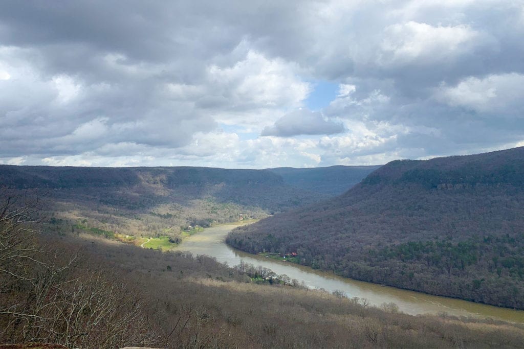
Whether you’re looking for a hike that will challenge you with changes in elevation or impress you with the sprawling views that come from the top, Chattanooga’s got you covered. Here are six trails in the area waiting for you to explore if you’re in search of Chattanooga’s most impressive altitudes.

Cumberland Trail: Signal Point to Edwards Point
The hike to Edwards Point is an out-and-back atop Signal Mountain with views of Middle Creek Gorge, the Tennessee River Gorge, and Chattanooga Valley. The trail is rated as moderately difficult, and it begins at Signal Point, where you’ll start with a 200-foot descent of a long wooden staircase known as “the mousetrap.” After a stop at Julia Falls Overlook, you’ll continue through lush forest, past boulders, and across a wooden suspension bridge. Watch your footing if the weather has been wet, because wet fallen leaves can make for slippery steps. You’ll pass Lockhart’s Arch on your left, then begin an ascent that leads to Edwards Point, which has its own majestic views of the water below.
How to Get There: Follow Signal Mountain Boulevard to the top of Signal Mountain, then turn left onto Mississippi Avenue. After the road merges with James Boulevard, turn left onto Signal Point Road.

Cumberland Trail: North Chickamauga Creek
This out-and-back 8.3-mile (each way) hike is rated difficult for the fact that you’ll hit 500-foot elevation losses and gains twice, plus rocks and boulders you’ll need to scramble over after the second set of ladders. You’ll find converted mining roads, steep slopes both down into and out of the river gorge, and a few waterfalls, depending on recent rainfall. Don’t feel like you have to tackle the entire North Chickamauga Creek Section of the Cumberland Trail to enjoy the views. You could opt for a hike from the parking area to Boston Branch Overlook alone. If you’ve still got energy once you’ve arrived at Boston Branch Overlook, you could commit to another 2.1 miles to the picturesque Stevens Branch Campsite. On your descent back towards the car, if it’s summer, take a detour on Lower Hogskin Loop, which will lead you across the creek to popular blue hole swimming spots.
How to Get There: Take I-27N from downtown Chattanooga to the Dayton Pike exit, turning left off the exit ramp. Follow Dayton Pike into Soddy Daisy, then turn left onto Montlake Road. Watch for the trailhead on your left before the switchbacks.

Snooper’s Rock: Prentice Cooper State Forest
A part of Prentice Cooper State Forest just west of Chattanooga, this spot offers a sprawling view of the Tennessee River as it winds in a horseshoe-shaped curve around the gorge below. Depending on the weather, you may even catch a cloud inversion on a morning when fog is hugging the river. For those who want the awe-inspiring views that come with elevation without a difficult hike, you can enjoy the overlook at Snooper’s Rock via an easy trek from the parking lot. Once at the overlook, you’ll have access to Mullens Cove Loop (and Mullens Cove Overlook), as well as Pot Point Loop.
How to Get There: Take I-27N to Signal Mountain Road, then turn left onto Suck Creek Road. After eight miles, turn left onto Choctaw Trail, left onto Game Reserve Road (also known as Tower Drive). From this road, you’ll find a parking lot that offers an easy hike directly to Snooper’s Rock as well as a separate trailhead with direct access to Mullens Cove Loop itself.

George W. Disney Trail: Chattahoochie-Oconee National Forest
Located 30 miles southeast of Chattanooga near Rocky Face, Georgia, this hike is short – only 1.5 miles out and back – but incredibly steep. While you will get some noise from area traffic, you’ll tackle more than 750 feet in elevation. In the winter, views to the north will include sightlines past Mill Creek Gap. At the top is the grave of Confederate soldier George W. Disney, plus views of Rocky Ridge, Taylors Ridge, Mill Creek, and Mount Vernon Creek.
How to Get There: Take I-75S to exit 336 in Georgia, follow US 41 North for 0.7 miles, then look for First Church of the Nazarene. Turn at the church, but pass the building, veer left again, and you’ll park near the Tipton Family Life Center.

Cravens House to Sunset Rock: Lookout Mountain
Cravens House Trail begins with a 300-foot elevation gain over half a mile before its junction with Bluff Trail. You’ll follow Bluff Trail’s rock walls and scenic views of Lookout Valley to a metal staircase up to Point Park. Stop here for one of the most iconic Chattanooga mountaintop views, then retrace your steps back down Bluff Trail for just over a mile to find Sunset Rock. The ascent to the overlook is intense, but brief. To add more difficulty to your climb, consider starting your hike at a trailhead on Garden Road near the Reflection Riding Arboretum and Nature Center at the base of Lookout Mountain. You’ll take Kiddie Trail to Skyuka Trail, walking for 0.2 miles until Gum Spring Trail shows up on your left. (Make sure it’s marked Gum Spring Trail. There’s another unmarked trail nearby.) Gum Spring Trail will meet up with Upper Truck Trail, which will take you to Sunset Rock.
How to Get There: Park at the historical Cravens House on Lookout Mountain to find the trailhead. Be mindful to finish your hike before dark, as the parking lot gets locked up once the sun goes down.

Cumberland Trail: Suck Creek Road to Mushroom Rock
This 6-mile (round-trip) out-and-back will start with a wicked, technical climb before flattening out on a ridge that will lead you to a sinkhole on your left. You’ll descend into the North Suck Creek gorge, cross a swinging bridge, then head back uphill. Before making the trip, check local records on whether the bridge has been repaired. If the water is down, the scramble across the rocks shouldn’t be too strenuous.
How to Get There: Take I-27N to Signal Mountain Road, veering right off the exit. Turn left onto Suck Creek Road, and drive for 6.2 miles. Where the Cumberland Trail crosses the road on both sides, you’ll park on the side of the road and hop the guardrail to begin.


